Find permits, services and guides relating to parking, roads and footpaths
Report an issue with a tree on public land
You can report a tree or tree branch that is obstructing the road, footpath or is in danger of falling or causing damage.

Apply for works, drainage and stormwater connection permit
You will need a Works and Drainage Permit (WDP) to undertake works that impact Manningham’s assets.
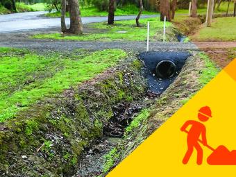
Report a blocked or damaged street drain
We are responsible for an extensive network of underground drains that prevent storm-water run-off from impacting property, footpaths and roads.
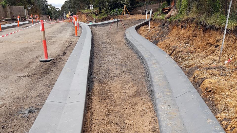
Drainage projects design and construction
Find out how we're improving drainage and flood mitigation.
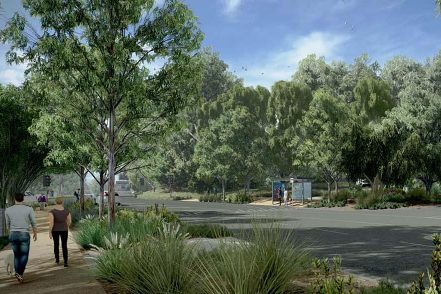
Footpath maintenance and construction
Find out about new path projects in Manningham including footpaths, shared paths and shared trails.
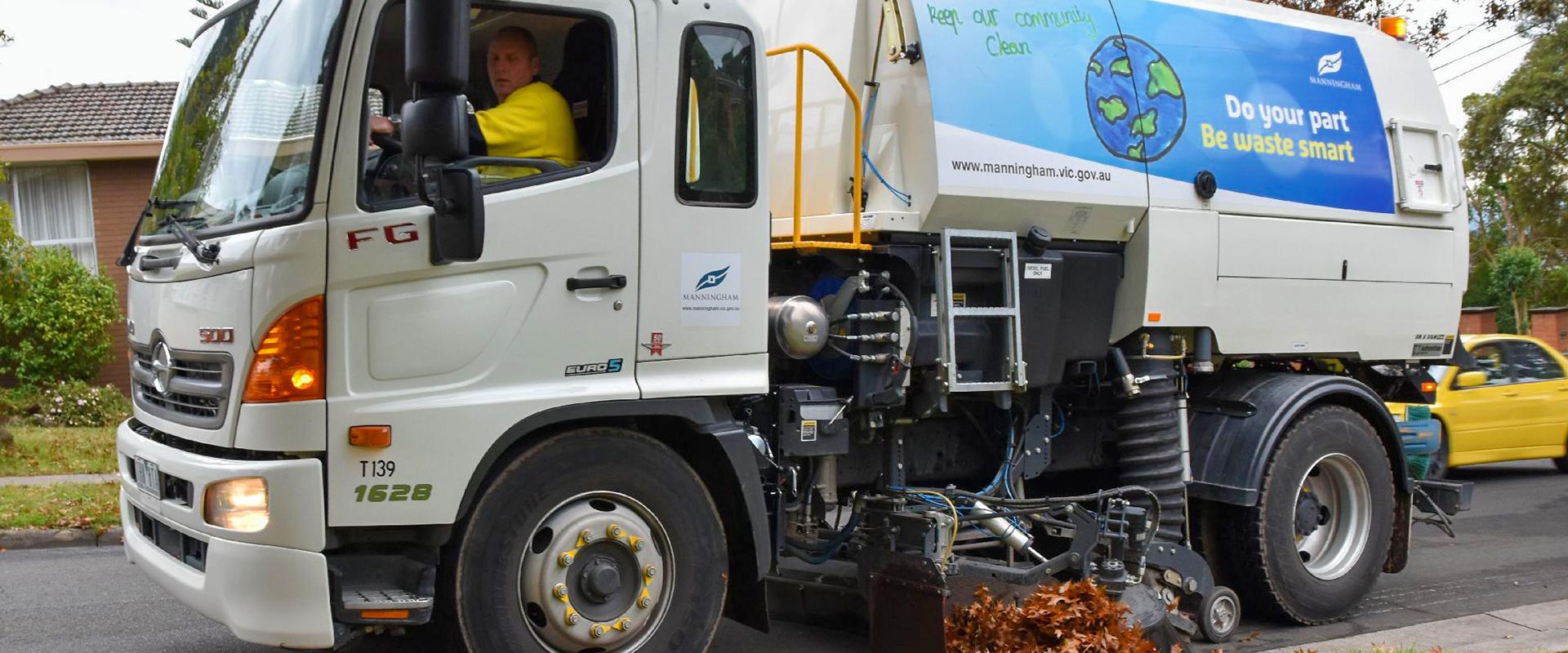
Street sweeping
We are responsible for maintaining 608km of local roads within Manningham. Find out more about our street sweeping program.
Can't find what you're looking for?
Increasing pedestrian movement
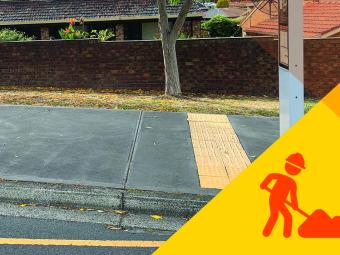
We plan the construction of our city’s footpaths, shared paths and trails by identifying the routes that pedestrians use more often on their journeys.
We use community feedback and other key areas to identify this network and locate where new footpaths are needed and plan for their construction.
Works to build a new footpath are prioritised by:
- the pedestrian demand
- the type of road
- its location relative to various facilities within the community
- the proximity to public transport.
Timeframes for new footpath projects can be affected by factors such as major road projects or large scale developments throughout Manningham.
Completed projects
Find out more about Manningham’s Road Management Plan....
This document sets out how we manage Manningham’s local road network, including more than 686 km of local roads, 912 km of pathways, and 980 km of kerb and channel.
The Plan is guided by the Road Management Act 2004 and aligns with our broader asset management and financial strategies.
Focus areas:
- Service standards define how often roads and footpaths are inspected and maintained.
- Roads and pathways are classified by use and importance to prioritise maintenance.
- Maintenance targets set response times for repairs based on risk and road category.
- The plan aims to reduce hazards and ensure safe travel for everyone.
Our responsibilities under the Road Management Plan
We manage local roads, while the Department of Transport and Planning manage arterial roads and freeways. However, not all infrastructure within the road reserve on local roads is managed by us.
For example:
- Property owners are responsible for maintaining vehicle crossovers and nature strips.
- Utility providers manage their infrastructure (e.g. water, gas, electricity).
How we maintain our roads
We use a four-tier inspection system:
- Reactive inspections: we respond to community requests.
- Proactive inspections: we schedule inspections based on road hierarchy.
- Condition assessments: we evaluate the long-term health of assets.
- Emergency works: we provide immediate responses to urgent hazards.
Maintenance is prioritised based on risk, usage, and available resources. Temporary measures may be used to mitigate risks until permanent repairs are completed.
Council Plan theme
View the links below to report an incident or make a request.
Frequently used:
If your request is urgent call us on 9840 9333
Waste and recycling
Property and development
Parking, roads and footpaths
Pets and animals
Make a complaint
Complaints help us improve our policies, practices and the way we deliver our services.

Give us feedback
Your feedback provides us a valuable opportunity to review our policies, practices and the way we deliver our services, and to make changes where necessary.
Find out more about the Manningham Links Road Improvement Strategy....
The Manningham Link Road Improvement Strategy aims to guide priorities for the future development of the remaining partially constructed link roads across the municipality. It focuses on upgrading Manningham's road network to enhance safety, support sustainable transport, and improve connectivity. It prioritises road projects based on safety, capacity, and economic efficiency while advocating for state funding and minimising environmental impacts in sensitive areas.
Focus areas:
- improving road safety
- supporting sustainable transport options
- improving connectivity between regional centers, local neighborhoods, and the Melbourne Central Business District
- prioritising road projects that offer the greatest benefit to the community at the lowest cost
- collaborating with state authorities to secure funding and support for essential road projects within the municipality
- minimising environmental impacts and supporting sustainable development practices.
Related Pages
Council Plan theme
We're striving for vision zero in Manningham, which means nobody is seriously injured or killed on our roads. Our Road Safety Strategy sets out clear objectives and a detailed action plan to help us get there.
Focus areas:
- Promote road safety within the local community.
- Reduce the number and severity of road crashes.
- Improve road user behaviour through targeted education.
- Provide safer roads by upgrading infrastructure and reviewing speed limits.
- Conduct road safety audits in high-risk areas.
- Manningham Road Safety Strategy and Action Plan 2025-2034pdf2.54 MBUPDATED: 8 September 2025download
Related pages
Council Plan theme
We encourage community members to join the Wonga Park CFA for this Bushfire community meeting.
This session covers fire safety essentials information including:
- Local fire risk
- What to expect from fire
- Preparing for fire
- Fire danger ratings
- How to stay informed
- Seasonal update
Other dates, times and locations:
Ruffey Lake Park’s Church Road North playground provides a different experience to the other playgrounds in the park. ...
Ruffey Lake Park’s Church Road North playground provides a different experience to the other playgrounds in the park.
Smaller and set amongst mature shade trees, the playground focuses on playing in the natural landscape and features a rock labyrinth, see-saw, swing suitable for all ages, junior see-saw and a cubby.
Cook something on the electric barbecues and enjoy a bite to eat in the large picnic shelter, or on the many picnic tables.
Parking
You can park the car in Church Road North.
Report an issue
Have you noticed something unsafe like a broken tree branch or damaged playground that needs our attention?
Organising a large event?
Some types of events, such as festivals or school's cross country runs need a special permission to be held on public land.
Below we have collated some of our popular applications.
On this page
Can't find what you're looking for?
Hosted by the Department of Transport and Planning, this 1.5 hour road safety awareness presentation is designed for older drivers and their families or carers.
The presentation provides advice on how older drivers can stay safe and mobile, including information on:
- how age-related changes can affect driving
- tips to optimise driver safety including a self-assessment checklist, vehicle design and road law
- the potential impacts of medical conditions, disability and medication on safe driving
- planning for the future
- where to access support and advice
We will also hear from Manningham Community Transport Partner, EV Strengthening Communities around alternative transport options for those who do not drive.
Places are limited, so register your attendance today.
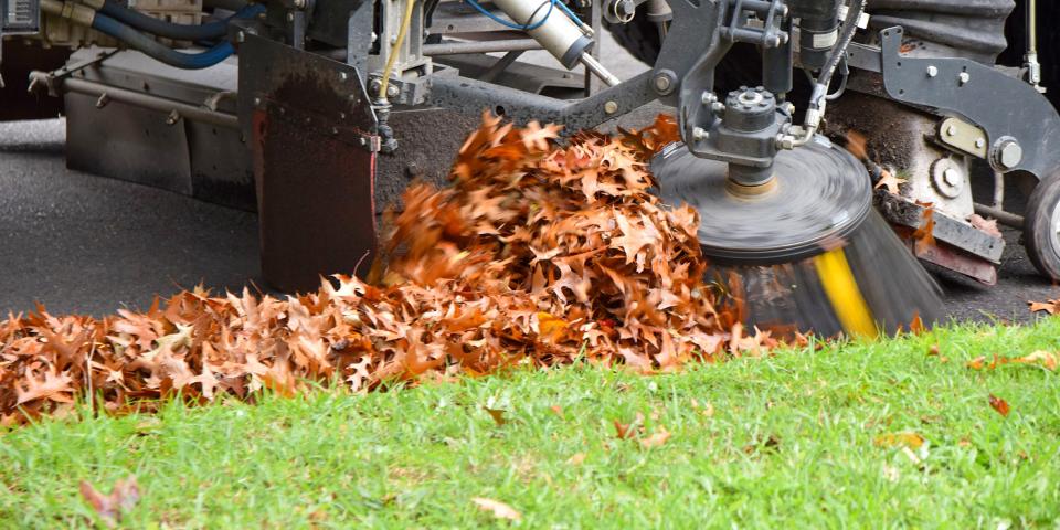
Under the Road Management Act 2004, we are responsible for street sweeping on local roads within Manningham to remove a build-up of fallen leaves and rubbish.
Why do we need street sweeping?
Street sweeping prevents the influx of leaf fall and litter from entering the underground drainage system potentially causing blockages, subsequent flooding and damaging the environment.
Litter not collected often ends up washing into open watercourses and into local creeks and the Yarra River.
Sweeping also benefits the overall amenity of the street, removes the build-up of dirt and leaves and reduces weeds along the kerb and channel.
What areas does Council sweep?
Council is responsible for maintaining 608km of local roads within Manningham.
Our street sweeping program includes:
- sealed roads with kerb and channel
- car parks and underpasses
- laneways and footpaths within Council maintained shopping precincts.
The Department of Transport and Planning (VicRoads) is responsible for maintaining the arterial road network.
When is street sweeping done?
Street sweeping is run throughout the year to keep our streets clean. We increase the frequency in a number of streets during Autumn when there is more leaf litter on the roads. Shopping precincts and key locations are given high priority.
| Area | Schedule* |
|---|---|
| Local roads within residential areas | Every eight to twelve weeks |
| Footpaths and laneways within shopping precincts | Fortnightly |
| Car parks within shopping precincts | 4 to 5 times per week |
| Car parks within our parks and reserves | Monthly |
| Underpasses | Every two months |
| Streets subject to heavy leaf fall during autumn | Monthly |
*This schedule is indicative.
We also respond to urgent sweeping requests such as storm events and traffic incidents.
What if my street needs sweeping?
Contact us for any urgent sweeping requests or potential hazards.
You will need a Works and Drainage Permit (WDP) to undertake works that impact Manningham’s assets.
Manningham's assets are generally located on public land beyond the property boundary and can include:
- private property connections
- stormwater Connection
- water works
- sewer works
- gas works
- electricity works
- communication works
- larger scale utility works along a street
- geotechnical investigations
- other types of works.
A permit makes sure all completed works is to a suitable standard and that members of the public are safe at all times.
Works that need a permit
You will need a WDP if you are planning on doing any work on any of the assets listed above. This can include stormwater and general utility connection works for the following:
- private property connections
- larger scale utility works along a street
- geotechnical investigations
- other types of works.
Stormwater and drainage connection work
Only a qualified plumber can do any water tapping and stormwater drainage connection work.
With a stormwater connection, you will also need approval and an inspection.
The applicant is responsible for public safety and traffic management
The applicant is responsible for managing public safety if applying for the permit. They are also responsible for reinstating Manningham’s assets to our standards following the works. There might be a requirement for an applicant to produce traffic management plans before permit approval.
Apply for a permit before starting works
-
You will need to apply for a WDP for all stormwater drainage connections before commencing any drainage connections.
-
You will a WDP before connecting a drain on private property to Manningham’s drains. Our drains include underground drains which share a common boundary with roads or are within easements on private property.
-
If you are planning to undertake works within a road, easement, footpath, nature strip or reserve we manage, you will need to get a WDP before starting.
You should apply for a WDP at least 10 business days before you plan to start the works.
The permit fee is $384. We will issue an invoice after completing an initial assessment of the application. You are not required to pay up front.
After receiving an application
After receiving your application and the documents, plans or drawings we require, we will make an assessment. We will also prepare the permit conditions. If we need further information, we will ask by email.
It may take up to 10 business days for us to email you an invoice. The permit approval will be sent after you’ve paid.
If you are no longer doing any work requiring a WDP, contact us to cancel your application or permit. If you have already made a payment and do not intend on doing the works, we will give you a refund.
Contact the coordinating road authority
You will need to contact the relevant coordinating road authority (CRA) before any work on a road reserve. The CRA will vary depending on whether the road reserve is under local, state or federal government control. To determine which CRA is relevant, contact us.
- Contact dial before you dig to find out if there are any utility services or infrastructure located below ground, either underneath or near your proposed works
- Code of practice for works within a road reserve
- A guide to working in the road reserve
- Companion to a guide to working in the road reserve brochure
- Consent to work on the road
You will need to include these in the site plan when applying.
Improving drainage and flood mitigation
We’re undertaking drainage works and upgrades across Manningham to reduce flood risk.
We prioritise drainage works by considering:
- knowledge of local flooding and relative impacts compared with other locations
- the scale of the required works
- asset condition records and maintenance history
- community feedback
- the timing of other proposed works, including roadworks.
Project timeframes may be impacted by various factors like major road projects or large-scale developments across Manningham.
Find out about the latest drainage projects in Manningham.
Flood and stormwater management
We’ve partnered with Melbourne Water to undertake flood mapping for Manningham, to better understand flood risk.
This work will assist flood management by:
- improving understanding of the frequency, severity and location of flood risks within catchments
- assisting Council to better plan and prioritise mitigation activities
- helping to plan for future development
- building community awareness of flood risk
- informing emergency management planning.
The Manningham Flood Mapping Project will also inform the development of Manningham Council’s Integrated Water Management Strategy.
This strategy will review flooding and stormwater management risks and respond to emerging challenges, including:
- population growth
- development pressure
- climate change and associated increasing flood and drought risk.
A new Stormwater Management Strategy for Manningham
We’re developing a Stormwater Management Strategy to help identify, manage and reduce flood risk to people, property, infrastructure and the environment.
The Strategy will guide our planning and investment in the long-term Capital Works Program to support a healthy, safe and resilient community.
You can use this permit to apply for:
- skip bins
- shipping containers
on council-owned land.
If the obstruction relates to building works, you may also need an asset protection permit.
How to apply
Download and complete the application form:
and then:
- email manningham@manningham.vic.gov.au or
- post to Approvals and Compliance Unit, Manningham Council, PO Box 1, Doncaster, Victoria 3108
An infringement, also known as either a fine or a penalty notice, is issued when a law or regulation is broken to help protect the rights, amenity and well-being of the Manningham community.
What happens if you receive an infringement notice?
Find a list of options available to you if you have received a penalty notice.

Guiding legislations (LGA and our Local Law)
View information on Manningham’s Community Local Law (2023), a local law made under Part 5 of the Local Government Act (1989 ) and section 42 of the Domestic Animals Act 1994, that further describes infringements and fines.
What types of infringements are issued?
We issue infringements that relate to:
- parking breaches
- animal management
- health and wellbeing
- food safety
- environment
- signage
- planning
- asset protection.
Increasing public transport movement
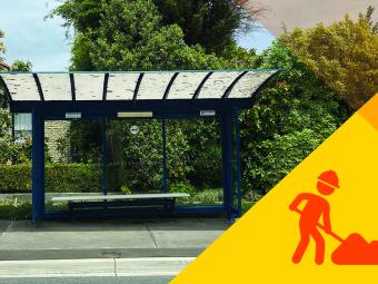
We identify and prioritise the routes and stops that commuters use most.
We consider community feedback, commuter demand and nearby services and facilities to identify locations where new shelters or upgrades are needed.
Works to build new shelters are prioritised by:
- commuter demand and historical requests
- the type of road the bus stop is located on
- the bus stop’s location relative to various facilities within the community.
On average, we aim to build between three and five, new or upgraded shelters every year.
The timing for new shelter projects may be influenced by factors like big road projects or large developments in Manningham.
Meeting Date: 28 September 2021
Meeting Time: 7.00pm
Location: Virtual meeting. You can watch the livestream on this page or on our Facebook page.
Coronavirus (COVID-19) and Council Meetings
As part of our efforts to contain the spread of COVID-19 we have reviewed our Council meeting practices to ensure we provide a safe environment for Councillors, staff and the community. Pursuant to the Local Government Act 2020, Council meetings will be held virtually until further notice. Physical attendance by members of the public at Council meetings is currently not permitted. Council meetings will continue to be live streamed and we encourage you to follow the meeting on our Facebook page (you can view the livestream on our Facebook page even if you don’t have a Facebook account) or website. The live stream is not interactive. Any comments or private messages directed to us while the stream is live will not be presented to Council or have a bearing on the conduct of the meeting.
Other temporary changes to our Council meetings:
Public Question Time – At this time, anyone wanting to ask a question of Council should submit their question via email by 5.00pm on the Monday before the meeting. As you cannot be present in the chamber, your question will be read out at the meeting by the CEO. For more information visit the Council Meeting Procedures page.
Council meeting livestream
- item_11.1_arundel_road_west_park_orchards_-_proposed_road_closure_report_and_attachmentspdf1.19 MBUPDATED: 29 October 2021download
What is an accessible parking permit?
Formerly called a disabled parking permit, an Accessible Parking Permit (APP) is for drivers or passengers with a disability. It's also for organisations helping transport people with disabilities.
The Victorian Government introduced the Accessible Parking Permit Scheme to help make a simpler and more consistent process.
All councils across the state will use the same application process. This aligns with the Australian Disability Parking Permit Scheme.
What improvements have been made to the process?
-
temporary permits will be available for six, 12 or 24 month periods
-
permanent permits will be valid for five years rather than three years
-
the introduction of a permanent disability classification, so functional assessments aren’t required for future permit renewals
-
a single and secure state wide permit design that will reduce permit misuse
-
the inclusion of occupational therapists as assessors and GPs
-
permits for organisations will continue to be available for 12 month period.
Which types of permits can you apply for?
There are two types of permits available:
-
Australian disability parking permit (ADP) - allows you to park in:
-
an accessible parking bay for the specified time limit.
-
a standard parking bay for twice the time limit specified.
-
-
Victorian double time accessible parking permit – allows you to park in:
-
a standard parking bay for twice the time limit specified.
-
A GP or occupational therapist functional assessment will decide on whether to issue a permit and the permit type.
How to apply or renew your accessible parking permit
For individuals
-
You will receive a reference number via SMS
If you don’t have access to a mobile phone or the internet, contact us.
-
Take your reference number to your GP or occupational therapist
-
Your GP or occupational therapist will complete a functional assessment and submit your application
-
We will review and confirm your application
-
If your application is successful, you will receive your permit in the mail.
For organisations
-
You will receive a reference number via SMS
If you don’t have access to a mobile phone or the internet, contact us.
-
We will review and confirm your application
-
If your application is successful, you will be advised when it is ready to be picked up from our civic centre.
When you collect your permit you need to bring the following supporting documentation:
-
Business registration(s)
-
Proof the vehicles are registered to your business.
-
How to replace a damaged, lost or stolen accessible parking permit
If your permit is lost, damaged or stolen, you can apply for a replacement online.
-
You will receive a replacement application reference number via SMS and email
-
We will review and confirm the application
-
If your application is successful, you can pick up your permit from our civic centre
When you collect your permit you need to bring the following supporting documentation:
-
the damaged permit (if replacing)
-
a statutory declaration for a lost permit
-
a statutory declaration or a police report for a stolen permit.
-
Need help?
What if you have an existing permit?
All existing permits that are not a part of the current Accessible Parking Permit scheme will remain valid until their expiry date or until 30 June 2023, whichever date occurs first.
Related links
Meeting Date: 24 August 2021
Meeting Time: 7.00pm
Location: Virtual meeting. You can watch the livestream on this page or on our Facebook page.
Coronavirus (COVID-19) and Council Meetings
As part of our efforts to contain the spread of COVID-19 we have reviewed our Council meeting practices to ensure we provide a safe environment for Councillors, staff and the community. Pursuant to the Local Government Act 2020, Council meetings will be held virtually until further notice. Physical attendance by members of the public at Council meetings is currently not permitted. Council meetings will continue to be live streamed and we encourage you to follow the meeting on our Facebook page (you can view the livestream on our Facebook page even if you don’t have a Facebook account). The live stream is not interactive. Any comments or private messages directed to us while the stream is live will not be presented to Council or have a bearing on the conduct of the meeting.
Other temporary changes to our Council meetings:
Public Question Time – At this time, anyone wanting to ask a question of Council should submit their question via email by 5.00pm on the Monday before the meeting. As you cannot be present in the chamber, your question will be read out at the meeting by the CEO. For more information visit the Council Meeting Procedures page.
Council meeting livestream
Agenda timestamps
00:00 - Opening prayer and statements of acknowledgement
06:35 - Passing of former Councillor Fred Chuah
13:00 - Kiwanis Club – Monster Raffle
15:36 - Petitions
24:10 - Public question time
29:21 - Planning permit applications
37:51 - City planning and community
45:42 - City services
49:46 - Procurement Policy review
53:35 - 10 Year Financial Plan 2021/22 to 2030/31
1:00:41 - Council Plan 2021-2025
1:06:10 - Strategic Risk Register
1:10:51 - Bulk Retirement of Council Endorsed Policies
1:20:21 - Review of Manningham's Governance Rules
1:25:47 - Documents for Sealing
1:27:26 - Councillors' question time
Along with VicRoads, we maintain roads and footpaths in Manningham to make sure they are safe and functional.
If you find an issue with one of our roads or footpaths, you can report it to us. We'll let you know if it's our road or VicRoad's.
Check what type of road or footpath you can report and where you can report it. If unsure, contact us.
Types of repairs we perform
- Pot holes.
- Damaged street furniture (bench seat).
- Sign posts (not light & telegraph poles).
- Damaged or uneven footpaths.
- Damaged or uneven kerb and channel.
- Damaged road surface (depressions, collapse, damaged speed humps).
How to report an issue
-
Prepare the following information before you report:
- The location of the issue.
- The date and time of when the issue occurred.
- Historic details leading up to you reporting this issue.
- Your contact details if you want to be kept updated. Alternatively, you can remain anonymous.
- Other details that will assist us with your specific issue.
-
Report the issue to us
You can make a report online, in person or over the phone.
What happens after you have reported an issue?
If the area is presenting an immediate danger, we will make it safe within 24 hours.
We will attend and repair the issue.
We will maintain the area in line with our footpath maintenance schedule.
