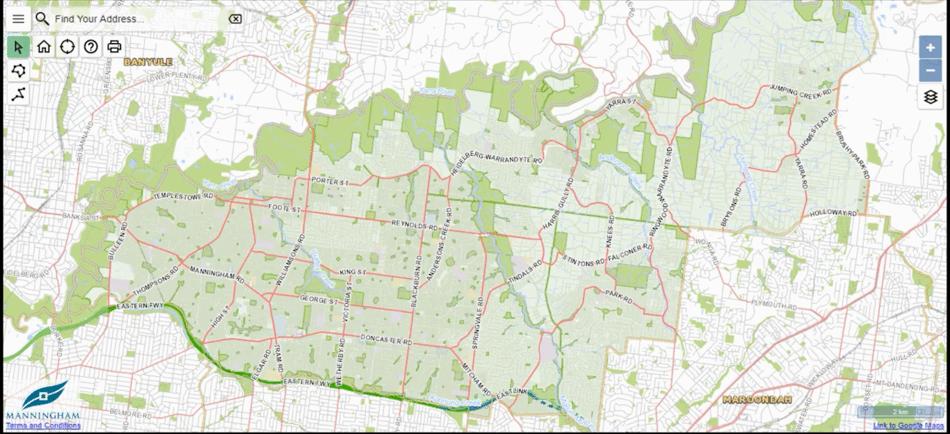
Explore our maps to find information about your property. View up to date and historical aerial photography and discover more about your neighbourhood. You can access the map below or view them in full screen.
Explore our maps to find information about your property. View up to date and historical aerial photography and discover more about your neighbourhood. You can access the map below or view them in full screen.
To access Mapping Manningham (the System) you are acknowledging and agreeing to the following terms and conditions of use:
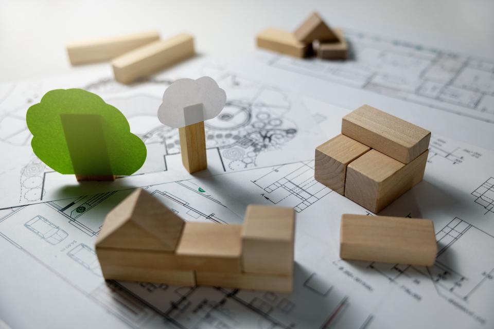
Get guidance on popular topics like removing trees or building fences to understand land-use, planning, building and infrastructure needs. You can also find links to important mapping and planning resources.
New to property and development?
Get familiar with the general permit process with our when do you need a permit guide.
Find out how to remove a tree or report issues with a tree on public land.
Understand what's needed when you have a pool or spa.
Find out about connecting to sewer and installing, removing or decommissioning a new septic tank.
Get advice and find heritage listed properties in Manningham.
These guides below may help you with planning your development:
View a range of links to advice and resources on things that will assist you in building a sustainable property.

View a range of links to advice and resources on things that will assist you in building a safe property.

View resources to help you prepare your property for various types of emergencies like bushfires, floods and storms.
Refer to the top left of the screen and select the What's nearby menu![]()
Select About Manningham > Wards from the menu listing
Select from Heide, Mullum Mullum or Koonung wards
The map will outline the area of the ward selected and a pop-up will appear at the bottom of the screen with links to more information on the ward, its Councillors, and community demographics.
Search for a property using the search bar in the top left corner
A pop-up will appear on the bottom of the screen, which will show the ward the property is located in
Select the ward to learn more information
Refer to the top left corner of the screen and select the What's nearby menu![]()
Select About Manningham > Suburbs from the menu listing
Select a suburb to view its location in Manningham. A pop-up will appear at the bottom of the screen with links to a brief summary and the community demographics of the suburb
Refer to the top left corner of the screen and select the what’s nearby menu ![]()
Select Key Destinations and choose from Neighbourhood Shopping Centres or Local Shopping Centres from the menu listing
Select a centre to view more information in the pop-up at the bottom of screen
Select Capital Works from the menu listing and choose a financial year in which the Capital Works was undertaken
Select a project to view more information about the budget and category in the pop-up at the bottom of screen
Refer to the top left corner of the screen and select the What’s nearby menu![]()
Select Health and Families > Maternal Child Health Centre from the menu listing
Select a Maternal and Child Health Centre
A pop-up will appear on the bottom of the page with links to more information on the centre. The centre’s address and phone number will appear under each centre in the listing to the left.
Search for a property using the search bar in the top left corner
A pop-up will appear on the bottom of the screen, which will show the Maternal and Child Health centre assigned to the property address
Select the Maternal Child Health link to view more detailed information about the centre.
Refer to the top left corner of the screen and select the What’s nearby menu![]()
Select Health and Families > Immunisation Sessions from the menu listing
The sessions will appear on the map. Select a session from the listing on the left to view more details about a session.
Refer to the top left corner of the screen and select the What’s nearby menu![]()
Select Health and Families > Childcare and Kindergartens from the menu listing
The child care centres and kindergartens will appear on the map. Select a location from the listing on the left to view more details.
Refer to the top left corner of the screen and select the What’s nearby menu![]()
Select Health and Families > Playgroups from the menu listing
The playgroups will appear on the map. Select a location from the listing on the left to view more details.
Refer to the top left corner of the screen and select the What’s nearby menu![]()
Select Health and Families > Retirement Village from the menu listing
The retirement villages will appear on the map. Select a location from the list on the left to view more details.
Refer to the top left corner of the screen and select the What’s nearby menu![]()
Select Facilities > Libraries from the menu listing
The libraries will appear on the map. Select a location from the list on the left to view more details.
Refer to the top left corner of the screen and select the What’s nearby menu![]()
Select Facilities > Council Venues for Hire from the menu listing
The council venues for hire will appear on the map. Select a location from the list on the left to view venue details.
Refer to the top left corner of the screen and select the What’s nearby menu![]()
Select Facilities > Sports Stadiums for Hire from the menu listing
The council venues for hire will appear on the map. Select a location from the list on the left to view venue details.
Refer to the top left corner of the screen and select the What’s nearby menu![]()
Select Facilities > Public Toilets from the menu listing
Public toilets in Manningham will appear on the map. Select a location from the list on the left to view a location.
Refer to the top left corner of the screen and select the What’s nearby menu![]()
Select Local Schools > Primary Schools from the menu listing to search for primary schools
Select Local Schools > Secondary Schools from the menu listing to search for secondary schools
Primary schools / secondary schools in Manningham will appear on the map. Select a location from the list to view links to more information on the school in the pop-up on the bottom of the screen.
Refer to the top left corner of the screen and select the What’s nearby menu![]()
Select Public Transport > Bus Stops from the menu listing
Bus stops situated in Manningham will appear on the map. Select a location from the list on the left to view more bus stop details in the pop-up on the bottom of the screen.
Refer to the top left corner of the screen and select the What’s nearby menu![]()
Select Active Manningham > Parks and Reserves from the menu listing to search for parks and reserves
Select Active Manningham > Dog Off Lead Areas from the menu listing to search for dog off lead areas
Select a park/reserve from the list on the left to view the location, visitor information and details about the park.
Refer to the top left corner of the screen and select the What’s nearby menu![]()
Select Active Manningham > Sports and Leisure Centres from the menu listing
Select a centre from the list on the left to view the location, contacts and details about the centre.
Refer to the top left corner of the screen and select the What’s nearby menu![]()
Select Active Manningham > Playgrounds from the menu listing to search for playgrounds
Select Active Manningham > Skate Parks/BMX Tracks from the menu listing to search for skate parks / BMX tracks
Select a playground / skate park / BMX track to view the location and more details on Manningham Council website.
| Icon Description | Icon |
|---|---|
| Change map icon |  |
| Click map icon | |
| Help icon | |
| Home icon | |
| Print icon | |
| Show your location icon | |
| What's nearby menu icon | |
| Zoom in icon | |
| Zoom out icon |
Refer to the top right of the screen and select the change map icon
Choose from aerial photography maps between 2019 and 1998
Select a property to view more detailed information about a property.
| Icon Description | Icon |
|---|---|
|
Change map icon |
|
|
Click map icon |
|
|
Help icon |
|
|
Home icon |
|
|
Print icon |
|
|
Show your location icon |
|
|
What's nearby menu icon |
|
|
Zoom in icon |
|
|
Zoom out icon |

Use the search bar in the top left hand corner to locate a property.
A pop-up will appear on the bottom of the screen, select Planning Zones to view all relevant planning zones.
Select a planning zone link to view more information
To view planning zones across Manningham, use the zoom in and zoom out icons or use the scroll on your mouse to view planning zones on each property.

Use the search bar in the top left hand corner to locate a property.
A pop-up will appear on the bottom of the screen, select Planning Overlays to view all relevant planning overlays.
Select a planning overlay link to view more information.
To view planning overlays across Manningham, use the zoom in and zoom out icons or use the scroll on your mouse to view planning overlays on each property.

Refer to the top left of the screen and select the What's nearby menu ![]()
Select Planning Applications from the menu.
Choose the type of application:
Select a planning application to view more information.
A pop-up will appear on the bottom of the screen, select View Permit Details to view the application.
Melbourne Water has designated land under Regulation 806 for proposed works/structures that may affect Melbourne Water's waterways and/or assets.

Refer to the top right of the screen and select the change map icon.
Choose the MelbWater Reg154 layer. The map will change to reflect the overlay on each property.
Use your mouse to scroll/zoom in and zoom out of the map to view in detail the overlay and which properties are affected.
Select a property to view more detailed information about the planning zones on a property.
| Icon Description | Icon |
|---|---|
|
Change map icon |
|
|
Click map icon |
|
|
Help icon |
|
|
Home icon |
|
|
Print icon |
|
|
Show your location icon |
|
|
What's nearby menu icon |
|
|
Zoom in icon |
|
|
Zoom out icon |
Congratulations on choosing Manningham as your new home.
Manningham prides itself on providing high quality services and a range of lifestyle needs for residents of all ages.
Manningham is located just a short distance from the Melbourne CBD yet you can enjoy a sense of being 'out of the city' thanks to our abundance of green open spaces, scenic outlooks to the ranges, and tranquil walks along our waterways.
It is this unique balance of city and country that makes Manningham such a special place to live.

We are proud to deliver over 100 different services to our vibrant and diverse community. Here are a few to get you started.

There’s something for everyone in Manningham. From sacred sites of the area’s First Peoples to the early gold mining settlements, the local area has a bit of everything for you to appreciate and enjoy.
Use our maps to search Manningham, property addresses, wards, healthcare centres and other places of interest.

Explore our local arts, crafts, fashion, food and drink and other recreational activities.

We are at risk of bushfires, flood and storms and work closely with authorities to plan for and be prepared in an emergency. Keep you and your family safe by being prepared and understanding your risks.

Stay in touch with everything that is happening at Council and around our community by subscribing to our monthly eNewsletter. Receive the latest news about our essential services, programs, projects and activities, straight to your inbox.
View and download the full Council Agenda below. A clearer version of the Attachments can be viewed separately by clicking on the item below. ...
Meeting Date: 29 September 2015
Meeting Time: 7.00pm
Location: Council Chamber, 699 Doncaster Road, Doncaster
View and download the full Council Agenda below. A clearer version of the Attachments can be viewed separately by clicking on the item below.
Come to a free outdoor Tai Chi session to Celebrate World Tai Chi and Qigong Day ...
Come and meditate in motion with a low-impact, mind-body exercise, which can help maintain strength, flexibility, and balance.
World Tai Chi Day is on Saturday 30 April and to celebrate, we're running a series of free outdoor Tai Chi and Qigong sessions for adults.
These two sessions will be at Mullum Mullum Reserve. They're one hour long, and facilitated by experienced instructor, Suzette Hosken, from Jade Lady Tai Chi & Qigong.
Come and try orienteering...
Come and try orienteering.
Orienteering is a sport in which participants use a map and compass to find points in the landscape.
Easy courses for beginners with coaching and assistance available on the day.
No equipment required.
Register beforehand or just turn up on the day.
Bring your friends and family along and try something new!
Find out when your bins are collected and how to present them. ...
If your bin collection day is on a Friday, you are likely to live in a designated high-fire risk area.
We postpone waste collection in these areas in extreme weather conditions and catastrophic days. If this occurs, leave your bins out until they are collected.
If you are not sure if your property is in a high fire risk area, check online.
Catastrophic days are different to Total Fire Ban days. Find out more on the CFA website.
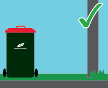
Place your bins out the night before and bring them in by the end of your collection day.
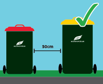
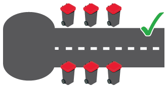
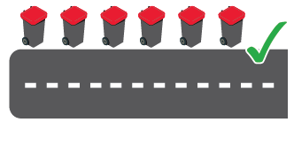
| At least half a metre (50cm) apart |
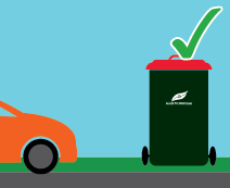
| With a minimum of 1 metre clearance from parked cars or any other obstructions |
| With a minimum of 1 metre clearance from trees, light poles or any other obstructions. |
| In a hammerhead or court bowl (cul-de-sac) Place your bins on the straight section of the street for collection. Keep the bowl of court free of parked cars. |
| In a dead end street Place your bins on one side to assist with collection. Keep the end of the dead end street free of parked cars. |
We offer a collection service for residents who, due to frailty, disability, medical or mobility conditions, are unable to place their bins out for the weekly waste collection.
Communicate with us through the Interpreter service if you do not speak or understand English.
A Neighbourhood Safer Place is a place of last resort when all other bushfire plans have failed. ...
A Neighbourhood Safer Place (also known as a Bushfire Place of Last Resort or NSP-BPLR) is a place of last resort when all other bushfire plans have failed.
Neighbourhood Safer Places are locations that may provide some protection from direct flame and heat from a fire, but they do not guarantee safety.
Neighbourhood Safer Places are not:
Many NSP-BPLRs are simply a clearing that provides separation distance from the bushfire hazard (e.g. forest).
You can find more information relating to Neighbourhood Safer Places at CFA.vic.gov.au
Manningham’s three NSPs are all outdoor and are located at:
Neighbourhood Safer Places (NSPs) are different from Emergency Relief Centres (ERCs).
In the event of an emergency, Victoria Police may instruct Council to open an ERC situated away from the location of an emergency to provide basic services and support to affected individuals and families.
An NSP does not have the same level of support or provisions or safety as an ERC.
Bimbadeen Reserve is a 2.6 hectare semi-developed reserve located opposite Finns Reserve....
Bimbadeen Reserve is a 2.6 hectare semi-developed reserve located opposite Finns Reserve. It contains a significant valley of Red Gums, mildly undulating, falling away steeply to Templestowe Road and provides views across Finns Reserve to the River.
It is naturally a very attractive reserve and conducive to walking, play, picnicking and other informal activities.
Facilities include:
Have you noticed something unsafe like a broken tree branch or damaged playground that needs our attention?
Some types of events, such as festivals or school's cross country runs need a special permission to be held on public land.
The Digital Accelerator Program is offering this free hands-on workshop to local Manningham-based businesses.
Learn new and proven concepts to help you understand local search engine optimisation (SEO) and use Google Business Profiles to grow your business. This session will cover:
Local Search Engine Optimisation (SEO) and why your business needs local SEO
Google Business Profile
Website local Search Engine Optimisation (SEO)
About the speaker
Alison Evans - Pinpoint Local Business (Owner)
Pinpoint Local Business is a digital marketing agency providing SEO services for local business and is a specialist for Google Business Profile optimisation strategies (formerly Google My Business GMB).
Google Business Profile (GBP) allows your business to easily connect with customers across Google Search and Maps. If you run a local business that serves customers at a particular location, or you serve customers within a designated service area, then Google Business Profile is your gold nugget. GBP helps local consumers find your business.
Besides providing full GBP management and Local SEO services for local business, Alison also provides presentations, workshops, and one to one mentoring sessions.
Join us for this free guided Wattle Identification Walk to see all fifteen local indigenous wattles. Most will be in flower or bud.
This nature walk is rated moderate and incorporates moderately steep and slippery sections.
Bring your own hat, sunscreen and water bottle. Wear sturdy shoes, a hat and clothing appropriate for the weather.
Location: Warrandyte. Exact location provided on booking.
Distance: 3km
Difficulty: Moderate (some steep and slippery sections)
Time: 2.5 hours
Registration: Essential. Please cancel your registration if you are unable to attend as we usually have a waiting list.
Walk will be cancelled if a Total Fire Ban or extreme weather event is declared.
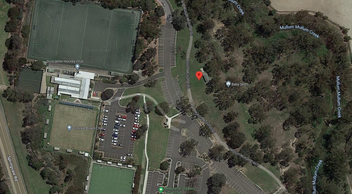
Join staff from Aquarena for a fitness session using the body weight fitness station at Ruffey Lake Park. ...
Join staff from Aquarena for a fitness session using the body weight equipment at the Lake Circuit Path Exercise Station at Ruffey Lake Park.
Sessions run for 45 minutes and are suitable for people of all genders aged 18 years and over.
No experience needed and all fitness levels welcome.
The Lake Circuit Path Exercise Station can be accessed through the Victoria Street or Church Road South entrance. More information, including a map link to the exact location, can be found on Ruffey Lake Park.
Whether you need official property information to support permit applications or for buying and selling properties - below are links to some of our most common requests:
View what types of building plans you can request a copy of and find out how to do it.
Find out how to request the types of Regulation 51 statements for buying, selling or preparing a building permit.
You may request a certificate of ownership for multiple needs. You may also use this link to find out who owns your neighbouring property for fencing purposes.
Get written advice about whether or not your proposed building, works or land use needs a permit.
Can't find what you're looking for?
Join staff from Aquarena for a session specifically tailored for older adults or those looking to get back into fitness in a gentle, supportive environment. ...
Join staff from Aquarena for a session specifically tailored for older adults or those looking to get back into fitness in a gentle, supportive environment.
Sessions will focus on stretching, strength and balance, using the equipment at Cricklewood Drive Exercise Station.
Sessions run for 45 minutes and are suitable for people of all genders aged 50 years and over.
No experience needed and all fitness levels welcome.
The Cricklewood Drive Exercise Station is located up the hill from the Church Road car park, along the Hilltops Circuit path. More information, including a map link to the exact location, can be found on Ruffey Lake Park.
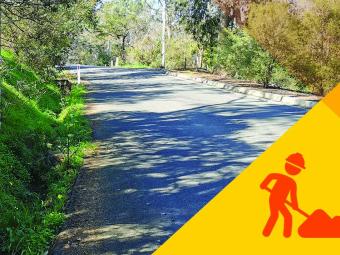
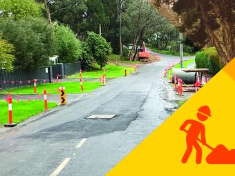
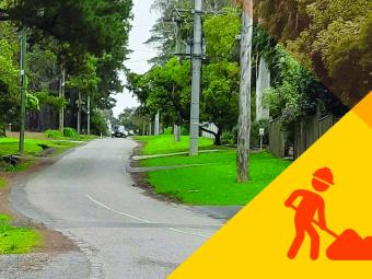
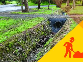
Find out how we're improving drainage and flood mitigation ...
We’re undertaking drainage works and upgrades across Manningham to reduce flood risk.
We prioritise drainage works by considering:
Project timeframes may be impacted by various factors like major road projects or large-scale developments across Manningham.
Find out about the latest drainage projects in Manningham.
We’ve partnered with Melbourne Water to undertake flood mapping for Manningham, to better understand flood risk.
This work will assist flood management by:
The Manningham Flood Mapping Project will also inform the development of Manningham Council’s Integrated Water Management Strategy.
This strategy will review flooding and stormwater management risks and respond to emerging challenges, including:
A new Stormwater Management Strategy for Manningham
We’re developing a Stormwater Management Strategy to help identify, manage and reduce flood risk to people, property, infrastructure and the environment.
The Strategy will guide our planning and investment in the long-term Capital Works Program to support a healthy, safe and resilient community.
New exhibition now on at Manningham Art Gallery. ...
An exhibition exploring works by several exceptional emerging artists, whose practices examine our natural environment from an aerial perspective, homing in on materials and subjects often overlooked.
These artists push, capture, map and rework the everyday. Through this process, pieces of refinement and polished simplicity form, like Rhys Cousins’ Plank and Brick. Or waste materials transform into rough jewel like sculptures as seen across Anni Hagberg’s works.
A highlight of the exhibition is Wurundjeri Artist Ash Firebrace’s Possum Skin Cloak he produced in collaboration with his sister Michelle Mills.
Interwoven throughout our space, are ceramic pieces from the Manningham Art Collection. A revisiting of works old and new.
Photo: Charlie Kinross
Tackling Racism is an event to mark United Nations International Day for the Elimination of Racial Discrimination. It is an opportunity to hear from people who have explored this topic extensively with local communities, and those with lived experience. ...
We acknowledge that racism continues to be a reality for many people in Victoria. This event provides an opportunity to hear from people who have explored this topic extensively with local communities, and those with lived experience.
Tackling Racism is an event to mark United Nations International Day for the Elimination of Racial Discrimination. Manningham Council has partnered with Victoria University on a project mapping racism where it occurs, understanding the reporting barriers and supporting the needs of people who experience it.
Come along to hear Dr Mario Peucker, Associate Professor and Principal Research Fellow, share his findings from the report. Lingzhi Ruan, from Womens Health East, will talk about their anti-racism project Taking Action to Combat Racism with Mandarin speaking women. The event will also feature a panel consisting of local community members and the Eastern Community Legal Centre sharing their insights and experiences on tackling racism and promoting equality.