Connecting our community through new facility construction is one of the ways we’re building a better Manningham.
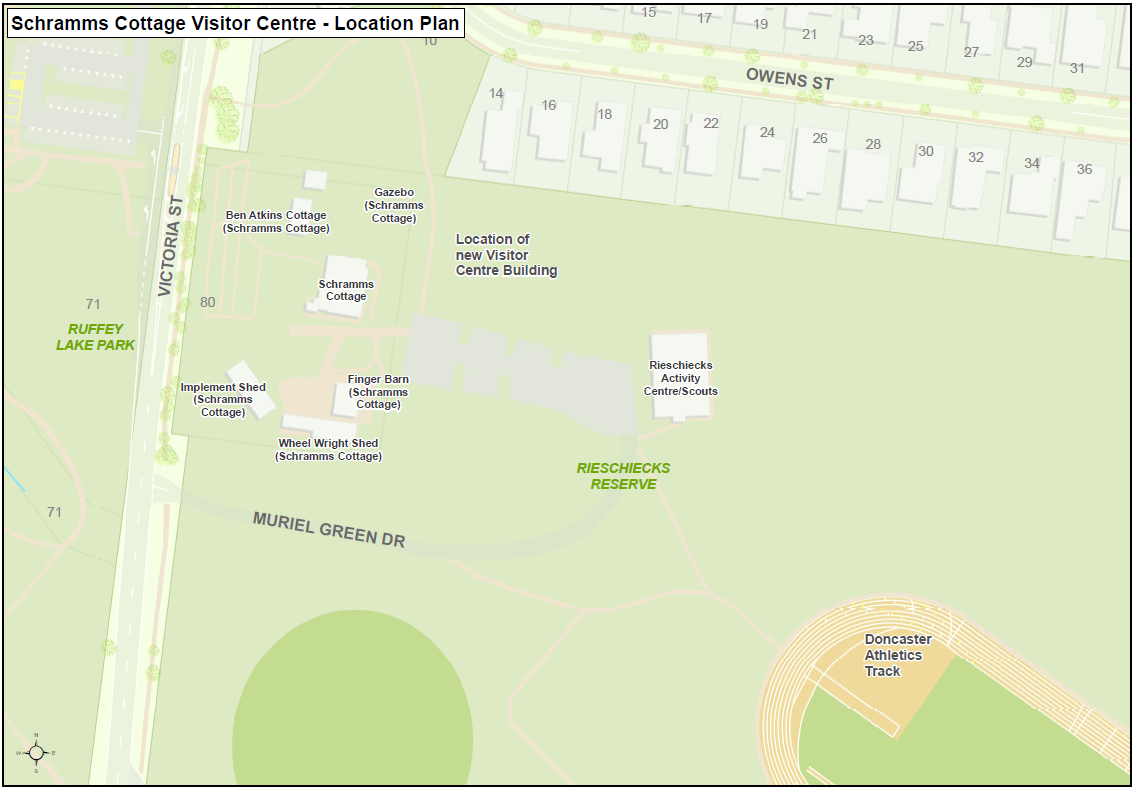
As part of our 2024/25 Capital Works Program, we’re building a new community facility at Rieschiecks Reserve.
The new modular building will be used by the Doncaster Templestowe Historical Society and other community groups.
The Visitor Centre will include:
- an exhibition space
- a meeting room
- offices
- public toilets
- kitchen
- an accessible path to Schramms Cottage.
Featuring an environmentally sustainable design, this building will create a welcoming interface to the Schramms Cottage Museum Complex.
Where is it?
The Visitor Centre will be built at Rieschiecks Reserve, between Schramm’s Cottage and the 1st Doncaster East Scout Hall, Doncaster East.
When will the works happen?
Construction will likely begin in early September 2024 and be completed by mid 2025.
This schedule is subject to weather conditions and third-party approvals.
We’re delivering this project as part of our 2024/25 Capital Works Program.
How will the works affect me?
The works will take place on weekdays during the hours of 7.00am and 5.00pm.
During construction, you may notice:
Construction noise
Minor traffic delays on Victoria Street, between George Street and Owens Street.
Footpath closures
Reduced parking available at the Schramms Cottage Museum Complex and the 1st Doncaster East Scout Hall.
We will have traffic management and signage on site to guide you through the area.
We appreciate your patience and understanding while we work to improve the footpath connections in your area.
Questions?
If you have any questions about these works, contact us.