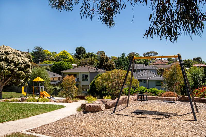
Kathleen Reserve is narrow and provides a path link for local residents to a bus stop on Manningham Road.
Kathleen Reserve is narrow and provides a path link for local residents to a bus stop on Manningham Road.
Have you noticed something unsafe like a broken tree branch or damaged playground that needs our attention?
Some types of events, such as festivals or school's cross country runs need a special permission to be held on public land.
Our kindergarten programs helps your child develop and is also a great opportunity for you to develop links with the community and other families. ...
Kindergarten is a wonderful environment for 3 to 5 year old children to play and learn. They will develop:
Kindergarten programs help develop your child's social emotional skills and is also a great opportunity for you to develop links with the community and other families.
In Manningham you will find funded kindergarten programs in:
Select the suburb to see the full list of schools in that area, their address and contact number.
| School | Address | Phone |
|---|---|---|
| Bulleen Pre-School | 5 Derreck Avenue, Bulleen | 43290426 |
| Creative Play Childcare and Early Learning Centre | 1 Templestowe Road, Bulleen | 9852 3277 |
| Kalker Montessori Centre | 1-3 Estelle Street, Bulleen | 9850 3500 |
| Bulleen Kids Early Learning Centre | 60 Manningham Road, Bulleen | 9850 2791 |
| Kids Academy Bulleen | 54 Thompsons Road | 70205356 |
| Moresby Avenue Child Care and Early Learning Centre | 6 Moresby Avenue, Bulleen | 9850 7755 |
| Vista Valley Kindergarten | 3 Vista Street, Bulleen | 9850 4043 |
| Wonderworld Early Learning Centre | 106 Templestowe Road, Bulleen | 9850 1777 |
| Yarraleen Pre-School | 92 Rocklea Road, Bulleen | 9850 8486 |
| School | Address | Phone |
|---|---|---|
|
Aurora Early Education Doncaster
|
104 Church Street Doncaster |
8820 8400 |
|
Creative Play Childcare and Kindergarten
|
522-524 Doncaster Road Doncaster |
9848 2157 |
|
Basement Level 1, Suite 11A, 687 Doncaster Road, |
||
|
|
53 Victoria Street Doncaster |
8822 0737 |
|
18 Studley Street, |
9857 6774 |
|
|
20 Turana Street, |
9840 2857 |
|
|
Imagine Childcare and Kindergarten Doncaster
|
1 Lauer Street Doncaster |
1300 001 154 |
|
Mykidz Early Learning Centre Doncaster
|
97 High Street Doncaster |
98578204 |
|
6 High Street, |
9857 8123 |
| School | Address | Phone |
|---|---|---|
|
2 Renshaw Street, |
9840 1488 |
|
|
Bambini Milgate Early Learning Centre
|
1 Fullwood Parade Doncaster East |
9699 3980 |
|
160 Anderson Creek Road, |
8658 1064 |
|
|
2 Damala Street, |
9842 6411 |
|
|
88 Polaris Drive, |
9842 5992 |
|
|
510 Blackburn Road, |
9842 9002 |
|
|
510-518 Blackburn Road, |
9842 1666 |
|
|
84 Blackburn Road, |
9842 3900 |
|
|
4 Montgomery Street, |
9842 1409 |
|
|
76 Anderson Creek Road, |
9842 1544 |
|
|
952 – 954 Doncaster Road, |
9841 8228 |
|
| 100 Deep Creek Drive Doncaster East | 9846 1168 | |
|
58-60 Larnoo Drive, |
9841 9556 |
|
|
13 Leeds Street, |
9842 9777 |
|
|
81 George Street, |
9841 7974 |
|
| 520 Blackburn Road Doncaster East | 9842 6726 | |
|
Corner Tunstall Road and Maggs Street, |
9842 9655 |
| School | Address | Phone |
|---|---|---|
|
9 Era Court, |
8877 8500 |
|
|
7 Florence Avenue, |
9874 6848 |
|
|
11 Mitcham Road, |
9841 7066 |
|
|
36a Mitcham Road , |
9841 0800 |
|
|
318-320 Springvale Road Donvale |
9593 9434 |
| School | Address | Phone |
|---|---|---|
|
64 Fyfe Drive, |
9850 5915 |
|
|
Templestowe Kids Early Learning Centre
|
11-13 Herlihys Road Lower Templestowe |
98520710 |
|
36-38 Parker Street Templestowe Lower |
9907 9392 | |
|
3 Birchwood Avenue, |
9850 8424 |
|
|
247-249 High Street, |
9850 9777 |
|
|
39 Mayfair Avenue, |
9850 8157 |
| School | Address | Phone |
|---|---|---|
|
239 Warrandyte Road, |
9876 1885 |
|
|
570 Park Road, |
9876 1618 |
| School | Address | Phone |
|---|---|---|
| Alpha Omega Early Education |
1 Hillcroft Drive Templestowe | 98463592 |
| Cuddly Bear Childcare and Kindergarten | 8 Swilk Street, Templestowe | 9846 4011 |
| Journey Early Learning Centre | 271 Thompsons Road Templestowe | 9005 4650
|
| Paisley Park Early Learning Centre Templestowe | 239 Foote Street Templestowe | 1800 724 753 |
| Templestowe Pre-School | 3 Swilk Street, Templestowe | 9846 2867 |
| Yarra Valley Preschool Inc | 34 Hakea Street , Templestowe | 9846 1836 |
|
Old Yarra Road, |
9722 1639 |
Manningham Council does not manage a central enrolment service. To enrol your child, contact the enrolment officer at the kindergarten of your choice or the childcare centre of your choice .
Visit Manningham Maps to find a local Kindergartens near you.
Funded kindergartens have several programs for children and families that need extra support. This can include a children who:
The state government funded preschool field officer program can help a child that needs extra assistance. If they’re attending a funded kindergarten program, they can get support that includes:
To make a referral, download and complete our referral and consent form:
For more info about the preschool field officer program, you can contact us via email.
The inclusion support program aims to grow the capacity of education and care services to include all children. Delivery of the program is by the community childcare association, in partnership with KU children’s services and Yooralla. This agency is the Victorian Inclusion Agency.
Find all schools, childcare, kindergartens and more within Manningham
Meeting Date: 25 November 2025
Meeting Time: 7.00pm
Location: Council Chamber, Civic Centre 699 Doncaster Road, Doncaster.
| Timecode | Item |
|---|---|
| 5. PRESENTATIONS | |
| 2:55 | 5.1 Motion of Condolence: Passing of Olga Lee |
| 5:25 | 6. PETITIONS |
| 6:15 | 7. PUBLIC QUESTION TIME |
| 10:25 | 8. ADMISSION OF URGENT BUSINESS |
| 9. PLANNING PERMIT APPLICATIONS | |
| 10:30 | 9.1 Planning Application PLN25/0134 at 35-41 Taunton Street, Doncaster East for the construction of 30, two-storey dwellings |
| 29:30 | 9.2 Planning Application PLN24/0477 at 722 Doncaster Road & 724 Doncaster Road |
| 10. CITY PLANNING AND LIVEABILITY | |
| 36:30 | 10.1 Adoption of Domestic Animal Management Plan 2026-2029 |
| 51:20 | 10.2 Adoption of the Public Toilet Plan 2025 |
| 1:13:00 | 10.3 Adoption of Onsite Wastewater Management Plan |
| 1:28:00 | 10.4 Statutory Planning Application Activity Quarter 1 (July to September 2025) |
| 11. CONNECTED COMMUNITIES | |
| 1:34:00 | 11.1 Gum Nut Gully Preschool Redevelopment |
| 1:49:50 | 11.2 Advisory Committees Review |
| 1:55:00 | 11.3 Early Years Infrastructure Plan |
| 1:28:00 | 10.4 Statutory Planning Application Activity Quarter 1 (July to September 2025) |
| 12. CITY SERVICES | |
| 2:10:00 | 12.1 September Capital Works Status report |
| 13. EXPERIENCE AND CAPABILITY | |
| 2:15:30 | 13.1 Manningham Quarterly Report, Quarter 1 - September 2025 |
| 2:21:25 | 13.2 Informal Meetings of Councillors |
| 2:25:20 | 14. CHIEF EXECUTIVE OFFICER |
| 2:25:25 | 15. URGENT BUSINESS |
| 2:25:30 | 16. COUNCILLOR REPORTS AND QUESTION TIME |
| 17. CONFIDENTIAL REPORTS |
Solar Savers is a trusted local government initiative that has helped households and businesses go all-electric since 2019. This initiative is supported by us and is available to all Manningham residents.
Solar Savers takes the hassle out of home energy upgrades. Backed by Manningham Council, the program has recently expanded to offer more suppliers and a wider range of products. It now also includes home energy assessments for personalised advice.
Solar Savers can provide you with:
Solar Savers can assist with quality and affordable:
Contact Solar Savers to book a home energy assessment or obtain a quote from trusted installers.
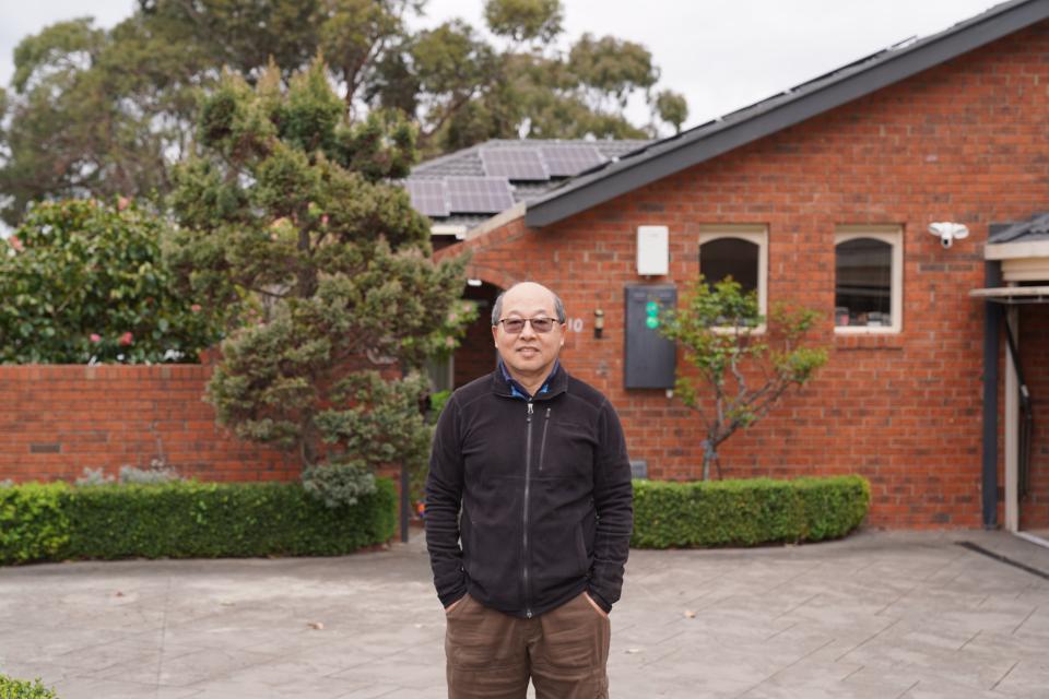
Manningham residents are going all-electric and reaping the rewards. Read about how they made the switch, as well as their top tips.
When Jeffrey installed solar panels on his roof in 2007, the system had only a 1kW capacity.
That first step planted the seed for what would become a 17-year electrification process.
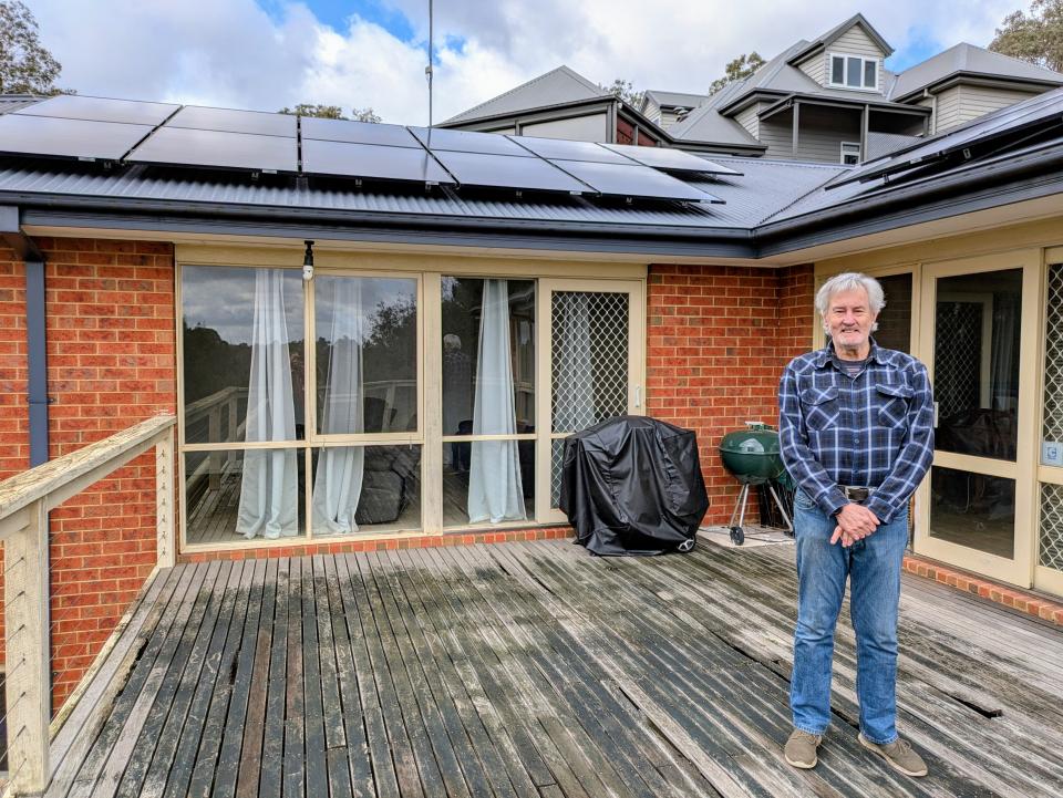
Rising costs led Paul to decommission his central gas heating.
After just one summer, he is reaping the rewards of his new 9.02kW solar system and battery storage.
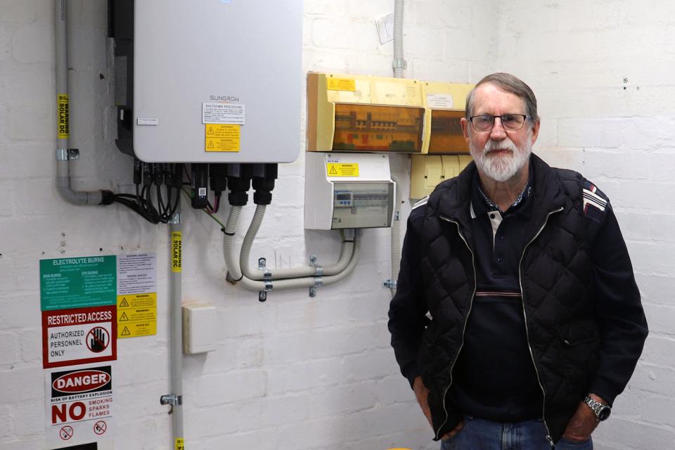
For country-raised Ken and his wife Joan, purchasing solar and a battery system simply made good sense.
Now, the Donvale residents are saving more with stable renewable energy.
We have several clubs in Manningham for older adults. The centres and clubs provide social and recreational opportunities for older people.
Looking for events for older adults? View the older adults page for details.
| Australian Coptic Senior Citizens Club | Doncaster East Hall Corner Blackburn Road and Andersons Creek Road 0413 076 344 | Board games, backgammon, walks. |
| Australian Oriental Martial Arts Tai Chi Incorp (AOMA) | Doncaster Secondary College David Perry Hall 0467 597 080 | Exercise, martial arts, Tai Chi. |
| Chinese Senior Citizens Club of Manningham | Ajani Centre 284 Thompsons Road, Lower Templestowe 3107 0427 040 894 | Guest speakers on relevant topics, dancing, board games, calligraphy. |
| Combined Pensioners Association of Bulleen and Templestowe | Lower Templestowe Community Centre Corner Manningham Road and Balmoral Avenue Lower Templestowe 3107 9850 5909 / 0400 858 954 | Board games, bingo, lunches and coffee, exercises, day trips, celebrations of significant cultural days. |
| Doncaster Chinese Senior's Association | Doncaster East Public Hall Corner Blackburn Road and Andersons Creek Road 0499 708 886 | Dancing, Chinese Opera. |
| Donvale Central Probus Club | East Doncaster Baptist Church 47-53 Tunstall Rd, Doncaster East 3109 Third Tuesday each month at 9.15am Noelene 0468 491 891 | Guest speakers on relevant topics, events, outings and social gatherings. |
| Doncaster Garden Club | Doncaster RSL Corner Leeds Street and Doncaster Road, Doncaster East 3109 0409 063 060 / 0402 478 302 | Guest speakers on relevant topics, discussions. |
| Greek Senior Citizens Club of Manningham | Ajani Centre 284 Thompsons Road, Lower Templestowe 3107 9850 4464 | Card games, bingo, guest speakers on relevant topics, celebrations of significant cultural days. |
| Iranian Senior Citizens Club of Manningham | Centenary House 901 Doncaster Road, Doncaster East 3109 8370 7083 | Carpet bowls, backgammon, cards, guest speaks on relevant topics. |
| Italian Senior Citizens Club of Manningham | Ajani Centre 284 Thompsons Road Lower Templestowe 3107 0413 040 027 | Card games, bingo, lunches on significant cultural days. |
| Macedonian Senior Citizens Club of Manningham | Ajani Centre 284 Thompsons Road Lower Templestowe 3107 0412 815 818 | Card games, social chat, lunches on significant cultural days. |
| Manningham U3A | The Pines Learning and Activity Centre 2/520 Blackburn Road, Doncaster East 3108 9894 5955 | Language classes, fitness classes, art classes, games, hobbies. |
| Rostrum Doncaster Club (Eastside Rostrum Club 61) | Senior Citizen's Club Lounge 895 Doncaster Rd cnr Doncaster Rd and Dehnert St Doncaster Opposite Jackson Court Shopping Centre Debbie 0414 632 866 or Andrew 0421 693 645 | Skill building, including public speaking. |
| Seniors Happy Life Club | Heimat Centre 125 George Street, Doncaster East 0402 985 812 | Folk dancing, Line dancing, African drumming, Ballroom dancing. |
| St Haralambous Church-Greek Senior Citizens | Parish of Saint Haralambos 190 to 200 Porter Street 0408 306 989 | Bingo, luncheons, day trips. |
| Warrandyte Senior Citizens Club | Warrandyte Community Hall 8 Taroona Avenue Warrandyte 3113 0417 546 604 | Bowling, billiards, social chat. |
| Women’s Friendship Group Inc | Lower Templestowe Community Centre Corner Manningham Road and Balmoral Avenue, Lower Templestowe 3107 9850 5252 / 0409 035 045 | Craft, exercise classes, monthly meetings. |
Contact the clubs directly if you are interested in joining.
You can also contact us or call 9840 9230.
Manningham Council acknowledges the Wurundjeri Woi-wurrung people as the Traditional Owners of the land and waterways now known as Manningham.
Council pays respect to Elders past, present and emerging, and values the ongoing contribution to enrich and appreciate the cultural heritage of Manningham.
Council acknowledges and respects Australia’s First Peoples as Traditional Owners of lands and waterways across Country, and encourages reconciliation between all.
Manningham Council values the contribution made to Manningham over the years by people of diverse backgrounds and cultures.
The following information has been written in consultation with the Wurundjeri Woi Wurrung Cultural Heritage Aboriginal Corporation.
Local Government plays a key role in activating Reconciliation within local communities by:
Council articulates how this can be achieved through a Reconciliation Action Plan (RAP).
The Manningham Innovate RAP 2023-25 has been developed in partnership with Wurundjeri Woi-wurrung Corporation, local First Nations peoples, local residents, Reconciliation Action Plan Working Group and Reconciliation Australia.
Council is committed to fostering respect for and understanding of First Nations cultures, histories, knowledge and rights throughout our organisation and the municipality.
The Reconciliation Action Plan Working Group will monitor the implementation of the RAP along with Reconciliation Australia.
In 2019, Council established regular Cultural Consultations with Elders and staff of the Wurundjeri Woi-wurrung Cultural Heritage Aboriginal Corporation (the Wurundjeri Woi-wurrung Corporation).
As the Registered Aboriginal Party for Manningham, the Wurundjeri Woi-wurrung Corporation plays a key role in decision making for and protection of cultural heritage and as such are recognised as the primary guardians, keepers and knowledge holders of Aboriginal Cultural Heritage.
The regular Cultural Consultations with Elders provide Council with an opportunity to ensure our projects, services and systems work towards progressing reconciliation.
The East Kulin Nation have lived in the area now known as Melbourne, for more than 65,000 years harnessing the rich resources of the Yarra River and surrounding bush lands and ranges. Part of the East Kulin Nation are the Wurundjeri people who spoke the Woi-wurrung language who are the Traditional Owners of Manningham.
Wurundjeri people called the Yarra River "Birrarung" – 'river of mists and shadows'. The Birrarung was central to the traditional Country of the Wurundjeri willam people. Throughout Manningham, Wurundjeri people lived near the Birrarung and its tributaries, caring for the many culturally significant places in the area. The Yarra Flats in Manningham are associated with the accomplishments of creation ancestors and spiritual beings. Bolin Bolin Billabong in Bulleen was an important living and eel fishing area, a place which Wurundjeri people requested for their reserved use in 1840. It remained an important living area and visiting place for Wurundjeri people returning from lyrebird hunting in the Yarra Ranges into the 1850s.
For thousands of years the Wurundjeri nurtured and protected this land and its creation stories, and in return, enjoyed the highest standards of living, health and wellbeing. The river was plentiful with teeming wildfowl in the wetlands of Bulleen, continual harvests in the fish traps, and freshwater mussel farms along the Yarra. The Stringybark and Manna Gum forests also provided abundant game and bush tucker for a population of several hundred people.
The Wurundjeri people shared the same belief system as the East Kulin Nation. The creation period stretches back to when the creation ancestors and spirit beings travelled across the land, creating and naming as they went.
Aboriginal and Torres Strait Islander people's oral tradition and religious values are based upon reverence for the land, and a belief in the creation period. The social moiety division and associated spiritual beings of the Woi-wurrung speaking people were Bunjil the wedge-tailed eagle and Waa the crow. Wurundjeri people were of the Waa moiety. During the creation period, Bunjil is their ancestor responsible for the creation of earth and men. Pallian the bat is their ancestor responsible for the creation of water and women. Waa was the protector of humankind.
Some very famous Wurundjeri people are associated with Manningham. In particular, William Barak and Simon Wonga who were both leaders of their community and have descendants still living in the region, some of whom are now Senior Elders themselves.
First nations cultural heritage places relate to a particular place that's considered to be a sacred or historically important place for First Peoples. However, it should be noted that not all First Peoples cultural heritage places hold significance to the Wurundjeri community. Within Manningham, we have more than 90 sites of Wurundjeri significance, some of which are the most significant within regional Melbourne. These sites include burial or birthing sites, trading places, travelling pathways, campsites and ceremonial sites, gathering places, mission sites, reserves, and places where conflict took place. Archaeological evidence or artefacts verify where such sites exist within Manningham, as well as stories passed down from generations of Wurundjeri Elders.
Pound Bend Tunnel Reserve, Warrandyte State Park, Pound Bend Road Warrandyte
Wurundjeri Stories is a fascinating and beautifully presented interpretive signage trail at Pound Bend that explores the Wurundjeri history, culture, traditional life, spirituality, events and the people linked to this sacred site.
There are seven signs, each containing in-depth historical accounts presented by a Wurundjeri working group, with stunning artwork and historical photographs, following a flat 1km riverside path, which walkers may wish to continue along the 3.5km River Walk or Loop Walk. Each sign features a section entitled ‘Bunjil’s Challenge’ which encourages walkers to explore the local surrounds in search of key features such as bush tucker, and to consider traditional lifestyle scenarios, making the trail an incredibly engaging, thought provoking and interactive experience.
Wurundjeri Stories is ideal for the casual walker, organised school and pre-school excursions, community groups and a ceremonial space for special Wurundjeri events. Groups are able to arrange for a Wurundjeri Elder or Educator to lead their organised excursion to the site.
A Wurundjeri Stories interpretive sign is also located at Wittons Reserve in Wonga Park, which shares the Wurundjeri history of this site, considered to be Sacred Women’s Country. The sign marks the beginning of the scenic Mount Lofty walk, a section of the Wurundjeri Songline route, the major Wurundjeri travelling route to the Yarra Valley.
For more information about the trail content, or to organise an Elder please contact the Wurundjeri Tribe Council at reception@wurundjeri.com.au or phone 9416 2905.
Resources to support your visit to Wurundjeri Stories at Pound Bend:
Welcome to Country and Acknowledgement of Country are important ways to recognise and respect Traditional Owners.
A Welcome to Country can only be performed by an Elder from the traditional custodial tribe. The Wurundjeri Woi-wurrung Cultural Heritage Aboriginal Corporation is the nominated Registered Aboriginal Party for Manningham, and as such all request for Welcome to Country ceremonies held within Manningham should be directed to the Wurundjeri Woi-wurrung Corporation. A Welcome to Country is a paid service and can be arranged by submitting an online booking request form.
An Acknowledgement of Country is a statement a speaker makes at the beginning of an event to acknowledge the traditional owners.
You can find out more about an Acknowledgement of Country at the Reconciliation Australia Website.
Stay informed about programs, services, council projects, opportunities and important news for our diverse communities.
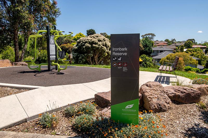
Ironbark Reserve playground consists of a swing set only. However, the reserve is used for open space and a handy pedestrian link to Gambier Avenue.
The Reserve is close to aged care facilities and Macedon Neighbourhood Shopping Centre. It provides important links for local residents to reach High Street and Manningham Road and their respective amenities.
Have you noticed something unsafe like a broken tree branch or damaged playground that needs our attention?
Some types of events, such as festivals or school's cross country runs need a special permission to be held on public land.
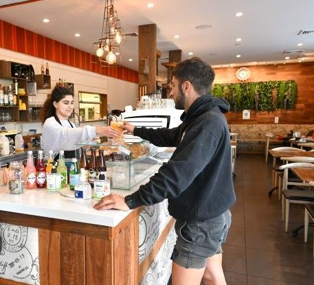
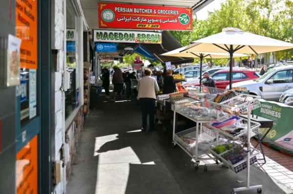
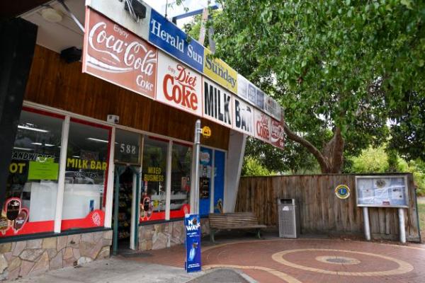
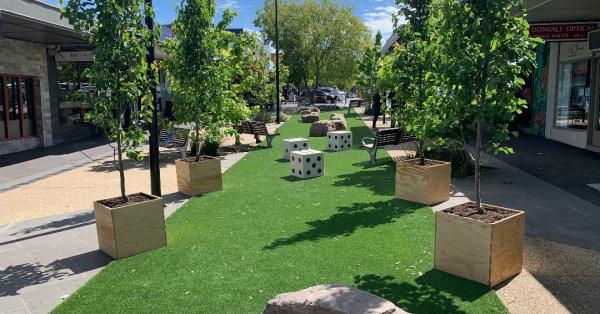
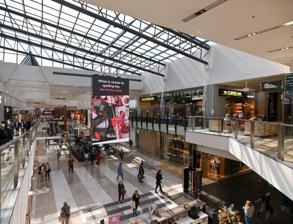
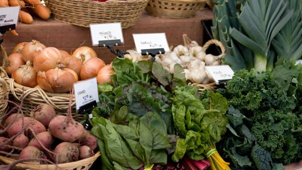
Visit our local shopping centres or markets for a little bit of retail therapy and to explore our local arts, crafts, fashion and food.

We have a range of local shopping experiences close to home that suit a variety of budgets and needs. From dog grooming to enjoying a tasty lunch, our friendly traders provide excellent service and are happy to help. Discover some of our great shopping locations today.
Styles Reserve is a pleasant pedestrian link between Barooga Drive and Styles Court. A path at the Styles Court end leads to ‘100 Steps’ down to Barooga Court.
The pedestrian link can also be used to access Wonga Park Primary School and Dudley Reserve. Scattered indigenous plantings are located at the Styles Court end. The nearest playspace is 300 metres away in Dudley Reserve.
Have you noticed something unsafe like a broken tree branch or damaged playground that needs our attention?
Some types of events, such as festivals or school's cross country runs need a special permission to be held on public land.
Lookover Reserve is a 0.9 hectare reserve located in a low density residential area and provides a link through a steep informal pedestrian track from Lookover Road to Glenwood Close.
The Reserve also has a drainage easement in the natural gully towards the front of the Reserve that also contains a Council drain.
Have you noticed something unsafe like a broken tree branch or damaged playground that needs our attention?
Some types of events, such as festivals or school's cross country runs need a special permission to be held on public land.
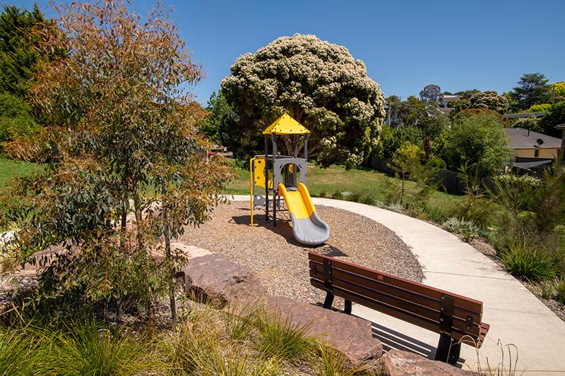
Richard Reserve is well linked to the local residents, attractively landscaped and has accessible paths to the playground. Play opportunities include a slide, swing, monkey bars and rockers. ...
Richard Reserve is well linked to the local residents, attractively landscaped and has accessible paths to the playground. Play opportunities include a slide, swing, monkey bars and rockers.
Suitable age group: 1 to 8 years
Have you noticed something unsafe like a broken tree branch or damaged playground that needs our attention?
Some types of events, such as festivals or school's cross country runs need a special permission to be held on public land.
Alan Morton Reserve is a linear reserve along a natural drainage line that runs alongside Park Road. It aids the pedestrian links to the Park Orchards centre from the south. ...
Alan Morton Reserve is a linear reserve along a natural drainage line that runs alongside Park Road. It aids the pedestrian links to the Park Orchards centre from the south. The Reserve is located within the Rainbow Valley Road, Biosite 20 and is considered a very high priority in Council’s Healthy Habitats Bushland Management Strategy 2012.
The Alan Morton Reserve Concept Plan was developed in 1995 and includes a wetland system to filter storm water runoff. As part of the Park Road upgrade in 2011, a shared path was constructed through the Reserve from Kebun Court to Enfield Avenue.
Have you noticed something unsafe like a broken tree branch or damaged playground that needs our attention?
Some types of events, such as festivals or school's cross country runs need a special permission to be held on public land.
Buckingham Reserve is an attractive treed reserve that functions as a small stormwater retarding basin and provides an pedestrian link between Menarra Street and Buckingham Crescent to the nearby Village Avenue Shopping Centre.
Have you noticed something unsafe like a broken tree branch or damaged playground that needs our attention?
Some types of events, such as festivals or school's cross country runs need a special permission to be held on public land.
Despite its relative small size, Montgomery Reserve located on the corner of Montgomery and Churchill Streets is well situated to provide a small green refuge for the workers and shoppers at the busy Doncaster East Village/Devon Plaza. The Reserve also houses Doncaster East Pre-school.
Amenities include a park seat under a shady tree, picnic table and rubbish bin. Playground is suitable for age group: 1 to 4 years.
Have you noticed something unsafe like a broken tree branch or damaged playground that needs our attention?
Some types of events, such as festivals or school's cross country runs need a special permission to be held on public land.
Miramar Reserve provides a pedestrian link from Miramar Court to Cat Jump Park via Ellerton Court. It can be used as part of a walking circuit for local residents and those of nearby Donvale Retirement Village.
Have you noticed something unsafe like a broken tree branch or damaged playground that needs our attention?
Some types of events, such as festivals or school's cross country runs need a special permission to be held on public land.
Kimberley Reserve provides a useful pedestrian link for the local community to access Templestowe Road and its associated bus stops and amenities. The Reserve contains a concrete path, a row of deciduous trees and lighting at either end.
The Reserve is part of the informal linear connection of parks from Pleasant Reserve to Birrarung Park via Sheahans Reserve, Morang Reserve, the Kimberley Way footpath and Kimberley Reserve.
Have you noticed something unsafe like a broken tree branch or damaged playground that needs our attention?
Some types of events, such as festivals or school's cross country runs need a special permission to be held on public land.
Decontra Reserve is a large and attractive reserve with scattered planted native trees. The nearby pedestrian link from Decontra Close to Pescara Place allows residents the opportunity for an extended walking circuit around the local area.
Have you noticed something unsafe like a broken tree branch or damaged playground that needs our attention?
Some types of events, such as festivals or school's cross country runs need a special permission to be held on public land.
Penderel Reserve is a large reserve linking Penderel Court, Bessa Court and Jumping Creek Road. The reserve is valued for its ecology, remnant vegetation and significant recreational opportunities due to its size and road connections. ...
Penderel Reserve is a large reserve linking Penderel Court, Bessa Court and Jumping Creek Road.
The reserve is valued for its ecology, remnant vegetation and significant recreational opportunities due to its size and road connections. The western end of the reserve is within the Clifford Park/ Bend of Isles Biosite 2 and is considered a very high priority in Council’s Healthy Habitats Bushland Management Strategy 2012. The open space and bushland area at the Penderel Court end is suitable for unstructured bush play activities.
Have you noticed something unsafe like a broken tree branch or damaged playground that needs our attention?
Some types of events, such as festivals or school's cross country runs need a special permission to be held on public land.
Chaim Reserve links local residents along a sealed path from Craig Road to Chaim Court. From the south side of Chaim Court, residents can gain access into the Mullum Mullum Creek Linear Park. ...
Chaim Reserve links local residents along a sealed path from Craig Road to Chaim Court. From the south side of Chaim Court, residents can gain access into the Mullum Mullum Creek Linear Park.
The Reserve contains remnant vegetation which forms part of the Hillcrest Reserve/ Chaim Court, Biosite 22 in Council’s Healthy Habitats Bushland Management Strategy 2012.
Have you noticed something unsafe like a broken tree branch or damaged playground that needs our attention?
Some types of events, such as festivals or school's cross country runs need a special permission to be held on public land.
This popular park on George Street in Doncaster East is close to Doncaster Gardens Primary School.
Highlights of the upgrade include:
Have you noticed something unsafe like a broken tree branch or damaged playground that needs our attention?
Some types of events, such as festivals or school's cross country runs need a special permission to be held on public land.